The Western Ghats Deadlock: Karnataka’s Resistance to the Kasturirangan Report
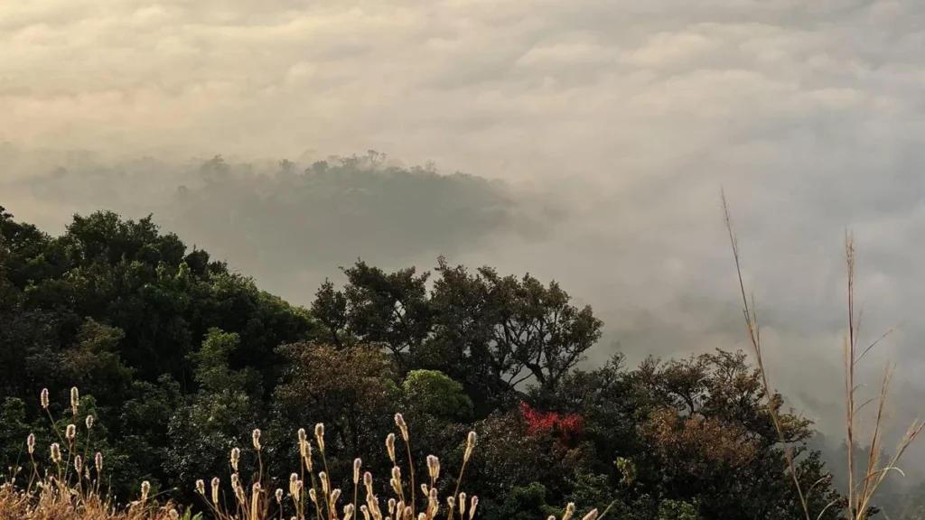
The Western Ghats, a UNESCO World Heritage site and one of the world’s eight “hottest hotspots” of biological diversity, has once again become the epicenter of a high-stakes confrontation between environmental conservationists and political stakeholders. On September 22, the Karnataka Legislature passed a unanimous resolution rejecting the latest draft notification issued by the Union Ministry of Environment, Forest and Climate Change (MoEFCC). This resolution marks the seventh time since 2014 that the state has formally pushed back against the implementation of the K. Kasturirangan Committee report, which seeks to designate vast tracts of the Ghats as an Ecologically Sensitive Area (ESA).
As the Ministry pushes to finalize the notification—which aims to impose stringent regulatory frameworks on land use—Karnataka’s resistance highlights a deepening schism between federal conservation mandates and the socio-economic realities of local communities living in the Malnad and coastal regions.
A Chronology of Conflict: A Decade of Stalling
The genesis of the current crisis lies in the competing visions for the Western Ghats’ future. The narrative began with the Western Ghats Ecology Expert Panel (WGEEP), chaired by Prof. Madhav Gadgil, which submitted its landmark report in 2011. The Gadgil report proposed a sweeping conservation strategy, designating the entire Western Ghats as an ESA and categorizing it into three zones with varying levels of restrictions.
Facing intense pushback from state governments—who feared the report would cripple development—the Union government appointed a High-Level Working Group (HLWG) in 2012, led by space scientist K. Kasturirangan. The HLWG submitted its findings in 2013, opting for a more "balanced" approach that sought to protect the most ecologically sensitive 37% of the Ghats, rather than the entire range.
Since the first draft notification based on the Kasturirangan report was published in 2014, the process has been trapped in a cycle of drafts and objections. The Ministry has released seven drafts to date, with the most recent appearing on July 27, 2024. Each time, the Karnataka government has filed objections, consistently citing the need for ground-level verification and the protection of local livelihoods.
Data and Demarcation: The Scale of the Challenge
The Western Ghats span approximately 1.64 lakh square kilometers across six states: Gujarat, Maharashtra, Goa, Karnataka, Kerala, and Tamil Nadu. The Kasturirangan report identified roughly 59,940 sq. km as “biologically rich” and “low fragmentation” areas that require ESA status.
Karnataka holds the largest share of this proposed ESA, spanning 10 districts. The current dispute hinges on the inclusion of 4,402 villages across the six states. Karnataka’s contention is not merely ideological; it is statistical. The state argues that the demarcation was conducted primarily through satellite mapping, which often fails to distinguish between protected forests and privately owned agricultural land, residential plots, or plantations.

State-wise Breakdown of Proposed ESA (Initial Estimates):
- Karnataka: 20,668 sq. km across 1,576 villages.
- Maharashtra: 17,340 sq. km across 2,159 villages.
- Kerala: 13,108 sq. km across 123 villages.
- Tamil Nadu: 6,914 sq. km across 135 villages.
- Goa: 1,461 sq. km across 99 villages.
- Gujarat: 449 sq. km across 64 villages.
While Kerala successfully reduced its ESA footprint to 9,993 sq. km by conducting a meticulous physical survey, Karnataka has yet to undergo such an exercise. Consequently, the state remains skeptical of the Ministry’s top-down data approach.
The Regulatory Framework: What is at Stake?
The Kasturirangan report proposes a binary regulatory environment. Certain activities are slated for an absolute ban, while others are to be heavily regulated.
The Banned List:
- Mining, quarrying, and sand extraction.
- “Red-category” industries (those with high pollution potential).
- New thermal power plants.
- Township and large-scale area development projects.
- Construction projects exceeding 20,000 square meters.
The Regulated List:
- Hydroelectric projects (permitted under strict environmental scrutiny).
- Infrastructure projects within 10 km of the ESA boundary, which must adhere to the EIA Notification of 2006.
Environmentalists argue that these measures are the bare minimum required to prevent the catastrophic landslides and floods that have plagued the Ghats in recent years. However, local farmers and villagers fear that these regulations will be enforced by forest officials with an iron hand, potentially criminalizing routine maintenance of farms or small-scale home renovations.
Official Responses and Political Posturing
The Karnataka Legislature’s recent unanimous resolution is a rare display of political unity. Cutting across party lines, legislators have argued that the state cannot accept the report in its current form because it lacks a “human face.”
The state government’s official stance rests on four pillars:

- Exclusion of Non-Forest Lands: ESA status should be restricted to notified forest areas and should not encompass agriculture, horticulture, or residential habitats.
- Inaccuracy of Data: Satellite imagery is an insufficient tool for land-use planning. A joint, physical survey involving revenue and forest officials is mandatory.
- Livelihood Security: The report provides no clear roadmap for how farmers can sustain their livelihoods under the proposed restrictions, nor does it address land tenure issues like Bagair Hukum (land cultivation without official title) and forest rights.
- The Kerala Model: The legislature is now pushing for a model similar to Kerala, where the state conducted its own ground-truthing, proving to the Centre that certain areas marked as “sensitive” were actually human habitations.
Implications: The Path Forward
The deadlock carries significant implications for both ecology and governance. If the Centre unilaterally declares the ESA, it risks sparking mass protests in the Malnad and coastal belts, where the memory of previous agitations remains fresh. Conversely, if the government continues to delay the notification, the ecological degradation of the Western Ghats—threatened by encroaching infrastructure and climate change—may reach a point of no return.
The Karnataka government’s decision to form a high-level committee, chaired by a retired judge and inclusive of all stakeholders, is a strategic move to buy time and create a legal shield. By seeking a one-year window to conduct a physical survey, the state is effectively shifting the burden of proof back onto the Union Ministry.
The Misinformation Gap
A critical challenge in this discourse is the spread of misinformation. Local leaders, often fearing a loss of political capital, have stoked fears that the Kasturirangan report will ban all home construction and agricultural activity. In reality, the report specifically targets large-scale industrial and real-estate developments. Bridging this communication gap is essential if any consensus is to be reached.
Conclusion: A Delicate Balance
The Western Ghats represent a complex mosaic of ecological necessity and human history. The Kasturirangan report is an attempt to quantify the value of nature, but it has stumbled on the difficulty of quantifying the value of a community’s right to exist.
As Karnataka embarks on its proposed physical survey, the rest of the country watches. The success of this endeavor will depend on whether the state can move beyond political posturing to provide credible, ground-level data that protects the environment without sacrificing the livelihoods of those who have acted as the forest’s traditional guardians for generations. The road to a sustainable Western Ghats is not through blanket prohibitions, but through a collaborative, transparent, and evidence-based approach that reconciles the needs of the planet with the needs of the people.